
Provo Neighborhood Guide: Explore Living in 2026
Provo’s mix of university energy, mountain scenery, and stable job growth positions the city as one of Utah County’s most studied housing markets. According to U.S. Census Bureau QuickFacts, Provo’s population exceeded 114,000 residents by 2023, with continued growth projected through 2026. Neighborhoods from Center Street to north bench subdivisions along Canyon Road offer distinct rhythms. This Provo neighborhood guide highlights how streets, schools, transit, and outdoor spaces shape everyday life for residents assessing where to live next year.
What Defines Provo’s Neighborhoods in 2026?
Provo’s neighborhoods cluster around three anchors: Brigham Young University, the historic downtown corridor, and transit routes like University Avenue and Freedom Boulevard. According to Walk Score, Provo posts an overall Walk Score near 53, but blocks around Center Street and University Avenue often feel much more walkable. Historic homes near Pioneer Park and North Park blend with newer townhomes along 500 West, producing a mix of architectural eras within a few blocks of each other.
Educational institutions influence neighborhood character across the city. Brigham Young University enrolls roughly 34,000 students as of 2024, based on figures from BYU Facts and Figures, concentrating student housing near Cougar Boulevard and 900 East. Farther north, Timpview High School and Rock Canyon Elementary anchor family-focused streets off Foothill Drive and Canyon Road. South Provo areas closer to Provo High School and Wasatch Elementary mix long-time owners with households arriving for employment at regional healthcare and technology employers.
Housing stock ranges from compact bungalows near Dixon Middle School to larger lots near Riverside Country Club and the Provo River Parkway Trail. According to Redfin data through early 2026, typical resale prices often fall between $400,000 and $650,000, while a limited upper tier of custom homes above University Parkway can reach or exceed $2.4M. That pricing spread means block-by-block differences in layout, finishes, and age carry meaningful weight for long-term planning.
How Do Central Provo and BYU-Adjacent Areas Compare?
Central Provo orients around Center Street, University Avenue, and nearby residential lanes such as 100 North and 300 West. Historic commercial buildings, the Provo City Center Temple, and restaurants like Station 22 Cafe and Guru’s Cafe create an active core. According to Walk Score, the downtown area reaches walkability levels approaching the high 70s, driven by dense storefronts and frequent bus service. Older single-family homes, turn-of-the-century cottages, and subdivided duplexes line streets within a few blocks of Pioneer Park.
On warm evenings near Center Street, the aroma of grilled food from food trucks in Pioneer Park mingles with the sweet smell of pastries from Hruska’s Kolaches on 300 North. Music from buskers echoes against brick façades, while string lights above restaurant patios cast a soft glow over tables along University Avenue. The steady hum of traffic on Freedom Boulevard fades a bit on side streets, where mature trees filter late sunlight over porch swings and narrow driveways.
Neighborhoods bordering Brigham Young University have a different cadence. Streets like 900 East, Birch Lane, and Carterville Road see heightened activity during semesters, with students walking or biking toward campus. According to enrollment and housing information summarized by BYU, a significant share of students live within roughly 1 to 2 miles of campus, concentrating rentals near BYU Creamery on Ninth and Kiwanis Park. Parking pressure, later-night noise, and frequent lease turnover distinguish these blocks from quieter single-family areas farther east.
What Characterizes North and East Provo Residential Corridors?
North Provo rises toward the foothills along Canyon Road, 2230 North, and Foothill Drive. Subdivisions near Rock Canyon Park and Rock Canyon Elementary often feature split-level or two-story homes from the 1970s through early 2000s. According to neighborhood school ratings from GreatSchools, several elementary campuses in this corridor score between 7 and 9 out of 10, contributing to steady buyer demand. Streets typically offer deeper lots, prominent mountain views, and proximity to trailheads leading into Rock Canyon.
East Provo neighborhoods closer to 900 North and Canyon Road balance university access with a more established residential feel. Duplexes, accessory apartments, and traditional single-family homes appear on the same block, particularly around 700 East and 820 North. According to housing data compiled by Zillow through late 2025, many homes east of University Avenue show value ranges roughly 10% to 18% higher than citywide medians, reflecting proximity to both campus and foothill recreation. Rock Canyon Park, with its open fields and cliffs, serves as a daily recreation outlet.
Farther north, the area around Riverside Country Club and 3700 North includes some of Provo’s larger properties along the Provo River corridor. Custom homes along University Avenue and Columbia Lane often include expansive backyards and mature landscaping. According to Redfin, inventory in this upper-price segment frequently stays below 20 active listings, which can sustain competitive conditions for buyers seeking river-adjacent or fairway-view properties. Nearby access to the Provo River Parkway Trail and Utah Lake State Park extends daily cycling and running options.
How Do South Provo and River-Bottom Areas Feel Day to Day?
South Provo stretches from roughly 300 South toward Provo Towne Centre and Interstate 15, with State Street and University Avenue serving as major spines. Subdivisions near Provo High School, Wasatch Elementary, and Exchange Park include a mix of mid-century ramblers, townhomes, and newer infill projects. According to Redfin, many entry-level homes south of 500 South still trade in the broad band between $350,000 and $500,000 as of early 2026, drawing first-time buyers and long-term renters.
Along the Provo River Parkway Trail near Exchange Park, the low rush of the river blends with bicycle tires humming over packed gravel and distant shouts from baseball fields. Cottonwood trees rustle overhead, and the air often carries a cool, earthy smell even on hot July afternoons. The glow from Provo Towne Centre’s signs appears over the treeline at dusk, while the soft thrum of traffic along University Avenue remains audible but not overpowering.
River-bottom areas west of Geneva Road and near Lakeshore Drive feel more rural despite rapid regional growth. Larger parcels, irrigation ditches, and views toward Utah Lake define many streets. According to population and density figures from U.S. Census Bureau QuickFacts, Provo’s average density exceeds 2,900 residents per square mile, yet these river-adjacent tracts often sit well below that figure. Utah Lake State Park, boat launches, and wetlands provide water access and bird habitat, while planned infrastructure improvements continue to shape long-term land use.
How Accessible Are Transit, Commuting Routes, and Daily Services?
Transit options cluster along Provo’s central corridors, especially near the Provo Central FrontRunner Station, University Avenue, and University Parkway. The UVX bus rapid transit line connects Provo Central, downtown, Brigham Young University, and Utah Valley University in neighboring Orem. According to Utah Transit Authority, UVX offers service every roughly 6 to 15 minutes during peak times, reducing parking dependence near campus and downtown. Neighborhoods within a short walk of UVX stops often enjoy faster regional commute times.
Commuting by car relies on major routes such as Interstate 15, State Street, University Avenue, and Geneva Road. According to statewide data summarized by Utah.gov, average commute times in the Provo-Orem metro hover near 20 to 22 minutes, shorter than many large metropolitan areas. Neighborhoods near 500 West and Center Street offer quick connections to I-15 interchanges, while north bench areas along Foothill Drive trade slightly longer drive times for views and access to trailheads.
Everyday services cluster along main commercial spines. Provo Towne Centre on Towne Centre Boulevard and big-box retail near University Parkway cover regional shopping. Closer to downtown, smaller businesses along Center Street, 100 West, and Freedom Boulevard handle daily needs from coffee to hardware supplies. Access to Utah Valley Hospital on 500 West and the Provo Recreation Center near 500 North provides medical and recreational resources within a few miles of most established neighborhoods.
What Practical Factors Matter Most When Choosing a Provo Neighborhood?
School zoning, housing type, and long-term redevelopment plans shape neighborhood decisions across Provo. Families often focus on proximity to schools such as Rock Canyon Elementary, Wasatch Elementary, Provo High School, and Timpview High School. According to GreatSchools, several of these campuses hold ratings between 6 and 9 out of 10, which can influence price differences of roughly 5% to 12% between adjacent attendance zones. Prospective residents frequently compare boundaries near 700 East, 2230 North, and Bulldog Boulevard when evaluating options.
On a winter evening near Kiwanis Park, the crunch of snow under boots accompanies the distant echo of cheering from the Marriott Center during a Brigham Young University basketball game. Porch lights along 900 East cast pools of yellow onto packed cars, and the smell of wood smoke drifts from chimneys on older bungalows. Students carrying backpacks weave past families unloading groceries, while the cold air sharpens views of the snow-bright Wasatch peaks rising above Canyon Road.
Financial planning also plays a role. According to housing-market summaries from Redfin through Q1 2026, Provo’s median sale prices have trended in a range roughly 25% to 35% below many Salt Lake County submarkets, yet competition remains strong near downtown and north bench areas. Factoring in potential HOA dues in newer townhome communities off Geneva Road, projected renovation costs in older homes near Center Street, and commuting tradeoffs along State Street helps align neighborhood choice with long-term priorities.
The 114,000-resident benchmark cited at the start of this Provo neighborhood guide reflects a city transitioning from college town to broader regional hub. That population figure from the opening underscores how demand for streets from Center Street to Canyon Road extends beyond semester cycles alone. The Utah Association of Realtors county-level market statistics provide ongoing context for inventory shifts affecting Provo’s neighborhoods. Buyers who register listing alerts through regional MLS-connected portals and commit to touring properties within 48 hours of listing during the late spring market window often secure stronger positions. Households delaying those steps until after the Q3 demand surge risk facing tighter inventory, higher competing offers, and reduced leverage when a suitable Provo property appears.
FROM OUR BLOG

Buying Your First Home? Here's What I Want You to Know Before You Start Looking
Buying your first home is exciting. It can also feel like someone suddenly started speaking a completely different language. Earnest money. Due diligence. Appraisal. Seller concessions. FHA. VA. Conventional. Closing costs. Underwriting. And somehow you're supposed to understand all of this while ma
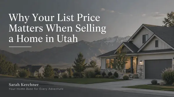
Why Your List Price Matters When Selling a Home in Utah
If you're thinking about selling your home in Tooele County or anywhere in Utah, there is one number I don't want you choosing based on emotion: Your list price. I understand why sellers want to start high. You love your home. You've invested money into it. Maybe you've upgraded the kitchen, finishe

Should You Buy a Home in Tooele County Now—or Wait for Interest Rates to Drop?
Should You Buy a Home in Tooele County Now—or Wait for Interest Rates to Drop? One of the most common questions I hear from buyers right now is: “Should I buy now, or should I wait for interest rates to come down?” It’s a completely understandable question. Your interest rate has a major impact on y